


Artificial intelligence has quietly reshaped nearly every corner of the technology industry over the past decade. From the recommendation algorithms that decide what you watch next to the voice assistants embedded in your pocket, AI has become the invisible engine powering modern life. But one of the most dramatic and visible applications of AI is happening not on a screen it is happening in the sky.
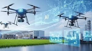
AI-powered drones are no longer a novelty or a niche military tool. They have become a serious industrial technology, and in 2026, they are arguably one of the fastest-growing sectors in the entire tech landscape. The combination of advanced machine learning, computer vision, real-time data processing, and increasingly capable hardware has turned unmanned aerial vehicles into precision instruments capable of tasks that would have seemed like science fiction just a few years ago.
This is a technology story worth paying close attention to because the implications stretch far beyond anything most people currently associate with the word “drone.”
From Remote-Controlled Toys to Intelligent Machines
The public image of drones has come a long way. For most of the 2010s, consumer drones were associated with aerial photography, hobbyist racing, and the occasional privacy controversy. Professional applications existed—filmmaking, inspection, some agricultural use but the technology was fundamentally limited by what a human operator could direct in real time.
The introduction of AI changed that equation entirely.
Modern AI-powered drones do not simply respond to remote commands. They perceive their environment, make decisions, adapt to changing conditions, and execute complex multi-step missions with minimal human input. Computer vision allows them to recognize and classify objects in real time. Machine learning models allow them to improve performance based on accumulated flight data. Edge computing allows them to process sensor information on board without depending on a constant connection to a remote server.
The result is a class of aerial vehicles that can operate autonomously in challenging, unpredictable environments and deliver data of a quality and quantity that no human-operated system could match.
The Hardware Revolution Driving AI Drone Capabilities
A significant part of what makes AI drones so capable today is the dramatic improvement in the sensor technology they carry. Modern professional drone platforms are not simply flying cameras. They are flying laboratories, equipped with a range of sensors that collectively paint a picture of the physical world in extraordinary detail.
LiDAR (Light Detection and Ranging) sensors fire millions of laser pulses per second and use the reflected signals to build precise three-dimensional maps of terrain and structures. These maps are accurate to within a few centimeters even across large areas, and they can penetrate vegetation to reveal what lies beneath the tree canopy or ground surface.
Thermal imaging sensors detect heat signatures, allowing drones to identify heat loss in buildings, locate people in search-and-rescue scenarios, and monitor industrial equipment for signs of malfunction. Multispectral sensors capture data across wavelengths invisible to the human eye, giving researchers and engineers information about vegetation health, soil composition, and surface materials that would be impossible to obtain any other way.
When all of this sensor data is fed into AI processing pipelines, the outputs are remarkable. Patterns emerge that no human analyst could identify manually across datasets of this scale. Anomalies are flagged automatically. Predictions are generated based on historical data. The drone becomes not just a data collection platform but an intelligent analytical system.
Transforming Industries One Flight at a Time
The industries being transformed by AI drone technology span virtually every sector of the economy. Construction companies use drone fleets to monitor site progress, generate volumetric measurements of stockpiles, and identify safety hazards before they become incidents. Energy companies deploy drones to inspect hundreds of kilometers of power lines, pipelines, and wind turbine blades in a fraction of the time traditional inspection methods would require.
Agriculture has been one of the early and enthusiastic adopters of AI drone technology. Precision agriculture platforms use multispectral drone data to generate crop health maps, identify areas of stress or disease, and guide variable-rate application of fertilizers and pesticides reducing chemical use while improving yields. What once required expensive satellite imagery or manned aircraft passes is now available on demand, at far higher resolution, from a drone that can be deployed in minutes.
The logistics sector is investing heavily in autonomous drone delivery systems. While regulatory frameworks are still catching up with the technology in many markets, drone delivery is already operational in parts of Africa, Australia, and the United States proving that the model works and setting the stage for much broader rollout as airspace management systems evolve.
AI Drones and the Rediscovery of the Past
One of the most compelling and surprising applications of AI drone technology is in archaeology and heritage preservation. This might seem like an unlikely frontier for cutting-edge tech, but the fit is extraordinarily natural.
Archaeological sites present exactly the kinds of challenges that AI drones are designed to solve. They are often located in remote or difficult terrain. They cover large areas that would take years to survey on foot. They contain subtle features slight variations in ground elevation, differences in vegetation growth, faint traces of buried structures that are nearly invisible from ground level but clearly detectable from the air with the right sensors.
Professional drone-based archaeological surveys using LiDAR technology have already produced discoveries that have rewritten our understanding of ancient civilizations. The technology can strip away centuries of vegetation cover in post-processing to reveal the bare terrain beneath, exposing road networks, building foundations, agricultural systems, and water management infrastructure that were completely unknown before the drone surveys were conducted.
Beyond discovery, AI drones are transforming how archaeological sites are documented and preserved. High-resolution photogrammetry the process of generating precise 3D models from large numbers of overlapping photographs allows entire sites to be digitally preserved in extraordinary detail. These digital records serve as permanent archives that can be studied by researchers around the world, used to monitor site changes over time, and consulted to guide conservation and restoration work.
The implications for cultural heritage preservation are enormous. Many of the world's most significant archaeological sites face serious threats from climate change, urban encroachment, conflict, and illegal excavation. AI drone technology makes it possible to document these sites comprehensively before damage occurs ensuring that the knowledge they contain survives even if the physical structures do not.
The Precision of Aerial 3D Scanning
Among the most technically impressive capabilities of modern AI drone platforms is aerial 3D scanning technology the ability to generate photorealistic, dimensionally accurate three-dimensional models of structures, landscapes, and objects from aerial imagery.
The applications of this capability extend far beyond archaeology. Civil engineers use drone-generated 3D models to plan infrastructure projects, assess structural conditions, and monitor construction progress with millimeter-level precision. Real estate developers use them to create immersive visualizations of proposed developments in their actual landscape context. Insurance companies use them to assess damage after natural disasters quickly and safely. Mining operations use them to measure stockpile volumes and monitor slope stability.
What makes AI drone 3D scanning particularly powerful is the combination of speed and accuracy it offers. A traditional ground-based survey of a large structure or complex terrain feature might take a team of surveyors days or weeks to complete. A drone survey covering the same area can often be completed in a matter of hours, with the processed 3D model available within a day. The data quality is comparable or superior, and the cost is a fraction of what traditional methods would require.
AI plays a crucial role in the processing pipeline. Aligning thousands of overlapping images, calculating depth information, filtering noise from point clouds, and generating clean mesh models are all computationally intensive tasks that AI-accelerated software handles orders of magnitude faster than traditional methods.
Autonomy, Safety, and the Road Ahead
One of the most significant ongoing developments in AI drone technology is the push toward greater autonomy. Current professional systems already handle many aspects of flight automatically obstacle detection and avoidance, automatic return-to-home on low battery, GPS-guided waypoint navigation. But the next generation of AI drone platforms is pushing much further.
Swarm intelligence the ability to coordinate large numbers of drones operating simultaneously as a unified system is moving from research labs into commercial deployment. Swarm-based survey operations can cover vast areas in parallel, dramatically compressing the time required for large-scale mapping projects. AI coordinates the individual drones, ensures complete coverage without duplication, and merges the data from multiple platforms into a single coherent output.
Beyond-visual-line-of-sight (BVLOS) operations where drones fly far beyond the range of direct human observation are becoming increasingly viable as AI navigation and collision-avoidance systems mature and regulatory frameworks adapt. This capability is fundamental to making large-scale drone operations economically practical, and its widespread availability will open up applications that are currently not feasible.
The safety profile of AI-powered drones is also improving steadily. Early drone operations carried significant risks of mid-air collision, flyaway incidents, and navigation failures. Modern AI systems incorporate multiple redundant safety layers sensor fusion, predictive failure detection, automatic safe-landing protocols that have dramatically reduced incident rates even as the number of operational drones has grown.
Why This Technology Matters Now
The convergence of capable AI, advanced sensors, improved battery technology, and maturing regulatory frameworks means that AI drone technology is moving from early adoption to mainstream deployment across industries. The organizations and sectors that move early to integrate this technology are building capabilities and data assets that will compound in value over time.
For the technology industry broadly, AI drones represent one of the clearest examples of how artificial intelligence creates value not by replacing human judgment, but by extending human capability into domains where direct human operation is impractical, dangerous, or simply too slow.
The sky is no longer just a medium for transportation. In the hands of AI, it has become a sensing platform of extraordinary power and the data it generates is already changing how we understand, manage, and preserve the physical world.
The next chapter of the AI revolution is not just happening on servers and smartphones. It is happening at altitude, at scale, and at a speed that is genuinely transforming what is technically possible across the entire technology industry.