


A Detour into the Mojave
On November 19, 2023, Shelby Easler, her brother, and their partners were driving back to Los Angeles from Las Vegas after the Formula 1 Grand Prix. That day, a heavy dust storm made travel on Interstate 15, the main route between the cities, especially difficult. Google Maps offered them an alternative—the app said this shortcut would save 50 minutes on what should have been a five-and-a-half-hour drive, as reported by CBS Los Angeles.
Shelby Easler told SFGate,
“Ironically, we thought this would be the safer choice, and the app clearly showed it would be 50 minutes faster.”
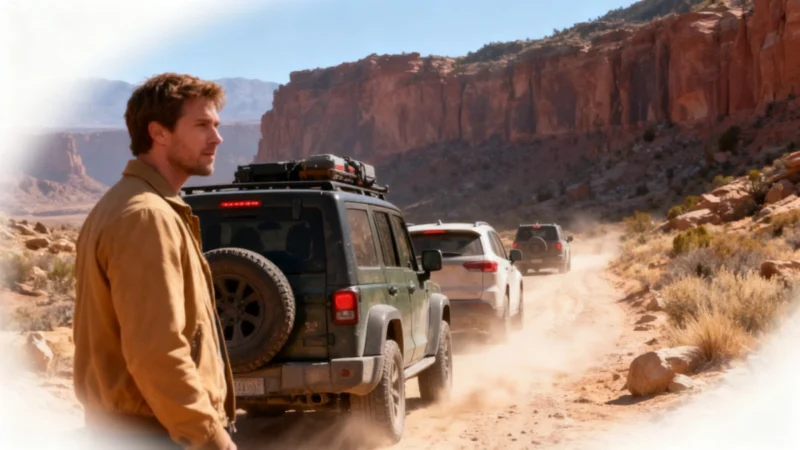
Trusting the app, they followed its directions off the highway onto a dirt road in the Mojave Desert, near Kingston Peak close to the Nevada–California border. They quickly realized they weren’t the only ones—SFGate reported at least a dozen other cars, while CBS Los Angeles reported the number could be as high as a hundred. Another family, the Strulls, told KTLA that Google Maps had also instructed them to exit at Cima Road.
Blocked in the Desert
The further they drove, the worse the dirt track became. According to Easler’s account on TikTok, cars could only creep along at about 3 kilometers per hour (roughly 2 mph) to avoid serious damage. It soon became obvious the road was impassable. Easler later recounted to CBS Los Angeles,
“This road leads nowhere, it’s been washed out, it simply doesn’t exist anymore—we had to turn around.”
Several vehicles became stranded, and drivers dialed 911 for help. However, the California Highway Patrol was overwhelmed with accidents from the dust storm on the main highway. On Shelby Easler’s brother’s car, the right rear tire came off entirely, and wheel alignment was ruined. The group waited five hours for a tow truck. Damage was estimated at about $5,000.00, and Easler finally returned home 14 hours after their departure.
Google Responds
A few days after the incident, Google responded to media outlets. A spokesperson stated,
“We apologize for this incident and will no longer route drivers traveling between Las Vegas and Barstow through these roads.”
The California Highway Patrol advised motorists to stay on major highways. Google Maps users can report incorrect routes directly in the app, with instructions available on Google’s help pages.
When GPS Directions Turn Dangerous
This wasn’t the only high-profile case of GPS guidance ending badly. On September 30, 2022, Philip Paxson drowned near Hickory, North Carolina. He was driving home from his daughter’s ninth birthday party when Google Maps, according to a lawsuit filed by his wife, Alicia Paxson, directed him late at night onto a bridge that had collapsed back in 2013. His Jeep fell about 20 feet into a creek. The lawsuit alleges Google had received repeated notifications about the collapsed bridge, including from a local resident, Kim Ellis. Google said at the time that it was reviewing the complaint.
A similar episode occurred in the summer of 2026. According to Arizona outlet AZFamily, Google Maps routed drivers off Highway 260 onto forest roads 64 and 198, roughly 19 miles northeast of Payson, Arizona. Several vehicles became stuck on those rugged, crowded, and impassable roads. In early July 2026, the Gila County Sheriff’s Office officially warned drivers not to follow Google Maps directions in that area.
The bottom line: GPS apps sound authoritative, but they can be painfully wrong. Trust, but verify, before you find yourself—or your wallet—stranded far from help.