


Here is something nobody tells you about the phone in your pocket: it already tracks satellites from four constellations, and on many 2018-or-later flagships, it reads two frequency bands at once. Google opened raw GNSS measurements to Android apps back in 2016. The chips were ready. What pinned them to blue-dot maps and geotagged photos was never the silicon. It was the data. A bare satellite fix drops you within a few meters. Closing the distance to a property corner or a flight line takes the one thing it never carried: a stream of corrections that turns meters into centimeters.
From Meters to Centimeters
That stream is the entire story. Here is how it runs. Real-Time Kinematic positioning, or RTK, measures a receiver against a network of fixed reference stations and ships the difference as RTCM messages over a protocol called NTRIP. The receiver applies the corrections, locks a fixed solution within seconds, and holds one-to-two-centimeter accuracy for as long as the link lasts. NTRIP travels over ordinary cellular data, which is the part that matters: any device with an NTRIP client subscribes to the same corrections, the Android phone in your bag included.
Where Mobile RTK Actually Lives
Strip out the jargon, and mobile RTK is two pieces of software on a handset: a survey app and a drone controller. A field crew pairs a phone with an external antenna and opens SW Maps to log boundary points. A pilot loads a flight in DJI Pilot, then drops NTRIP credentials into the network-RTK field. One subscription covers both. RTKdata is one such service, and its RTK for drones offering shows the shape of it: hardware-agnostic corrections for any NTRIP-capable receiver or drone, drawing on more than 20,000 reference stations across 140-plus countries, with GPS, GLONASS, Galileo, and BeiDou support.
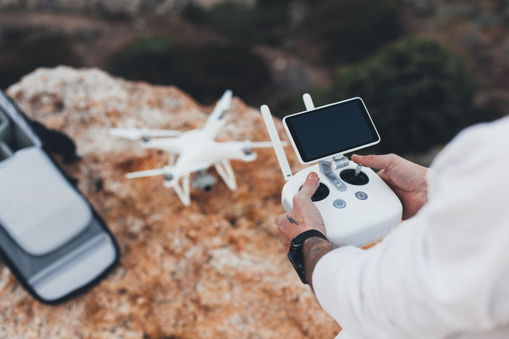
For an Android user, this is the genuinely interesting part. The phone stops reporting where it sits and becomes the instrument: controller, screen, and data link in one slab of glass. The handset that gives you directions to the job logs survey-grade points once it arrives.
The Handset Finally Keeps Up
The hardware earns its credit because the leap was real. The Xiaomi Mi 8 shipped the first dual-frequency GNSS chip in a phone in 2018, and the feature spread fast across the Pixel and Galaxy lines after that. That shift has been traced across recent smartphones and wearables. Dual-frequency reception sharpens the raw fix, and with a correction feed layered on top, it pulls a phone within touching distance of a dedicated receiver. Survey-grade work still wants an external antenna bolted on, but the brain of the rig now fits in one hand.
The setup looks like every Android app you have configured. Open the NTRIP settings, type in a host, a port, and a mountpoint, sign in with the credentials the service issues, and switch on position reporting so the network knows where you stand. A few seconds later, the status reads FIX, and the app starts banking survey points or feeding waypoints to a drone. No tripod base station to lug, no radio link to pair, nothing to post-process at the desk that night.
One Feed, Many Industries
The same feed surfaces in industries that share nothing on the surface. Drone mapping took to it first: an RTK position stamped onto each photo at the shutter kills the ground-control-point chore that used to eat an afternoon of post-processing. The scale is enormous. The FAA logged more than 16.6 million commercial drone flights in 2024.
Farming runs the biggest fleet of centimeter positioning on earth. Auto-steer guidance reached 70 percent of large-scale U.S. crop farms in 2023, and those rigs lean on RTK to keep a 24-row planter dead straight across a half-mile pass. Construction pipes the same coordinates into the machine control, so an excavator blade meets design grade on the first cut instead of the third.
Robots use it, too. A delivery cart, a commercial mower, and a security patrol all fuse RTK with onboard sensors to stay inside a boundary instead of wandering into a flowerbed. Transportation pushes it into lane-level guidance and rail alignment, where a single centimeter draws the line between a system you trust and one you do not.
The Network Behind the Fix

None of this rests on the drone or the tractor. It rests on the network behind the fix. Coverage sets the outcome: a dense backbone of reference stations, four-constellation support, and sub-second latency. Where the network is thick, and the sky is open, a phone holds the exact fixed solution a five-figure receiver once monopolized.
The chips were ready in 2016. The data caught up later, and it arrived over the same connection the phone used for everything else. For a generation that never thought of a phone as a measuring tool, that is the quiet revolution: the precision instrument was in your hand the entire time.