


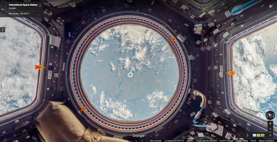
The International Space Station (ISS) has orbited the earth for 16 years now, but a scant few of the world's population ever get the chance to experience it for themselves, instead, that privilege was limited to scientists and other highly educated folk conducting experiments and collecting data, until now. Thanks to Google, the ISS has become the first ‘off planet' location to be added to Google Maps' Street View app that recently achieved the 1 billion install status.
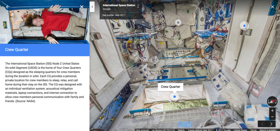 In case you were wondering, Google didn't send up a Street View car to the ISS, instead, it enlisted the astronauts to help take the 360° panoramas of the vessels' innards, with helpful little notes to give more details on what you are busy looking at.
Thanks to the unique location and difficulty in getting to the ISS, Google had to rely on the astronauts to take the panoramic pictures with the DSLR cameras present on the space station. Due to the lack of tripods, the work schedule of the astronauts, and the basic lack of gravity, there were unique obstacles that had to be overcome, with 24 images needed to create a single panoramic image. All-in-all, it took 4 months to finish the project, because it had to be squeezed in around the astronauts' duties. You can see how the International Space Station was mapped out by checking out the Behind the Scenes video we've embedded below.
Source: Google

